The Kymin is home to two interesting Georgian buildings and a host of wildlife. The steep climb up from Monmouth is rewarded with spectacular views of the Abergavenny mountains and, beyond them, the Brecon Beacons.
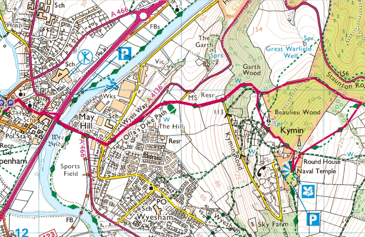
Leave Agincourt Square via Church St. Turn right down St Mary’s St and at the end turn left and immediately right into Wyebridge St. Use the underpass to cross the A40 dual carriageway and cross the Wye Bridge. As you cross the bridge you see the Kymin ahead on the skyline with the white Round House clearly visible.
Carry on over two small roundabouts and bear left along the main road at the Mayhill pub. In 150 yards, take the Offa’s Dyke Path (ODP) on the right to climb up through the woods. Carry on in the same direction when the path arrives at a tarmac lane with an orchard on your left. At the main road carry on uphill to a gate on the left signposted Offa’s Dyke. Staying on the ODP, carry on uphill through the woods to a junction of paths where you take the path through the gate and carry on between two fences.
Where the path meets a road, turn left heading uphill to reach a gate on the left where there is a finger post, ODP . Through this gate and uphill The easier path is to the left of the original narrow, rutted path and leads to steps where there is a Kymin sign. On the right is the Roundhouse, a circular, castellated Georgian banqueting house. From here the views are stunning and on a clear day you’ll see Pen Y Fan, the highest peak in the Brecon Beacons.
A short distance from the Roundhouse is the Naval Temple, a monument to Admiral Lord Nelson who visited the Kymin with Lady Hamilton over two hundred years ago.
Returning to the Roundhouse, drop down onto the old bowling green and head for the left hand side of the stone cottage where a finger post at a gate points to Staunton Road. Crossing the field you have views of the densely wooded hills of the Forest of Dean. Carrying on downhill through a second gateway from where you see the third gate which brings you to a gate at a stoney track. Turn left here and after ¼ mile take the path off to the right. Ignore paths off to the right and left to reach a gate on the left where you rejoin the path you came up. Carry on downhill through the woods, through a gate and downhill on the road. Where the road turns sharply right go straight ahead on the private road with the orchard on your right.
Take the narrow path straight ahead downhill to the main road. Heading left, take the road back across two small roundabouts and the Wye Bridge. Use the underpass under the A40 and rejoin Wyebridge St before turning left at the Queens Head and immediately right into St Mary’s Street. At the end of St Mary’s St take Church St back to Agincourt Square.


